The Great Lakes: Interactive Lakescapes
The Great Lakes are a rich site from which to explore connections and relationships.
Trade, recreation, ecological and historic preservation, architecture, and storytelling—these and many other activities have given rise to interactive in-person and web-based exhibitions, intersections of art and science, and historical and ecological tours.
The Great Lakes Architectural Expedition
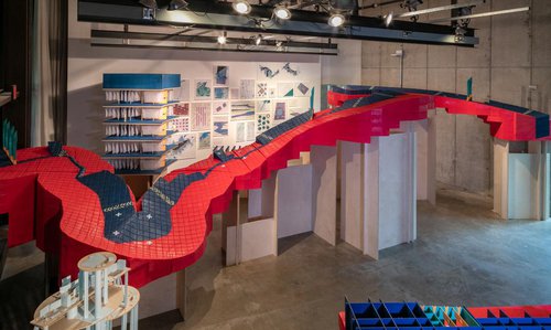
Responding to environmental and political threats to Lake Erie and the other Great Lakes, residents of Toledo, Ohio founded the Great Lakes Architectural Expedition. This experimental public architecture office is entrusted with protecting the spirit of the Great Lakes Compact. The Expedition launched a fundamental re-thinking of architecture’s role in the Great Lakes Megalopolis as part of its mission. Using archival models, drawings, documents, and studies, this exhibition is a rare glimpse into the office’s archives and how it’s members imagined their work as public advocates and architects of non-human architect-client relationships.
Image credit: The Ohio State University. Description: Photograph of part of the Great Lakes Architectural Expedition exhibition.
The Ways: Stories on Culture and Language from Native Communities Around the Central Great Lakes
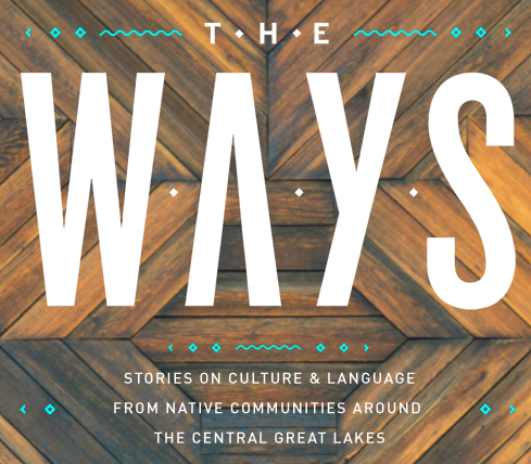
The Ways is an ongoing series of stories from Native communities around the central Great Lakes. This online educational resource for 6-12 grade students features videos, interactive maps, and digital media exploring contemporary Native culture and language. The Ways supports educators in meeting the requirements of Wisconsin Act 31, seeking to expand and challenge current understanding of Native identity and communities.
Image credit: theways.org. Description: Photograph of The Ways website, with the title in large, bolded white lettering and wooden design as the background.
Andrea Vander Woude blends science and art to study the Great Lakes from the sky
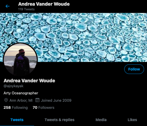
The Great Lakes offer myriad possibilities for interdisciplinary creativity. Andrea Vander Woude is an oceanographer who uses satellites and airborne cameras to study the Great Lakes from the sky and map harmful algal blooms, rip currents and submerged aquatic vegetation. “My day is spent programming, writing algorithms to process the images and looking at beautiful imagery,” Vander Woude reflects, “It is a wonderful blend of science and art!”
Image credit: Vander Woude's twitter. Description: A photograph of Vander Woude's twitter profile.
New interactive map highlights Great Lakes shipwrecks and their lore | Michigan Shipwrecks
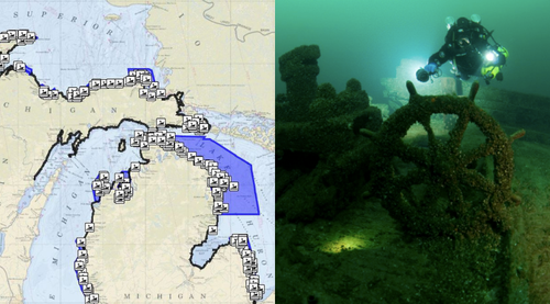
Historians and archaeologists also draw on inspiration from the Great Lakes. Shipwrecks are a popular subject of research and fascination. Interactive maps and visual exhibitions of the Great Lakes shipwrecks invite audiences to explore these rich and tragic stories of the region’s history.
Image credit: TV6 and Michigan History Center. Image description: On the left is a map of the Great Lakes and on the right is an underwater photograph of a diver exploring a shipwreck.
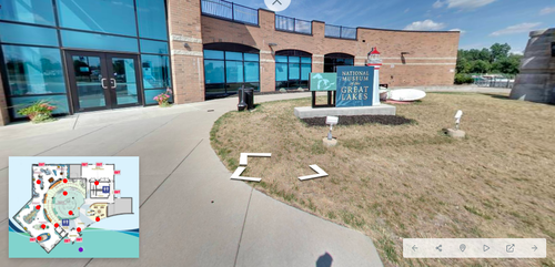
National Museum of the Great Lakes virtual tour
If you are curious to learn more about the history and culture of the Great Lakes, The National Museum of the Great Lakes offers a virtual tour of its museum exhibits and the Col. James M. Schoonmaker Museum Ship. There are other virtual exhibitions and resources on the museum’s website.
Image credit: National Museum of the Great Lakes. Image description: Photograph of the outside of the museum.
For more information click here to check out our Great Lakes Cultural Resource Guide!
[Hero image description: The banner image at the top of the web page is a photograph a person swimming in a lake. The swimmer is mostly submerged under water and obscured behind splashing water. One arm, wearing a black wetsuit protrudes from the water. Image credit: Unsplash]
Become a Member
Being a member of the Chicago Humanities Festival is especially meaningful during this unprecedented and challenging time. Your support keeps CHF alive as we adapt to our new digital format, and ensures our programming is free, accessible, and open to anyone online.
Make a Donation
Member and donor support drives 100% of our free digital programming. These inspiring and vital conversations are possible because of people like you. Thank you!